Spin the globe, let it go around and around and put your finger on a little dash of colour that has never caught your attention before. A spot that sits on a part of the sphere you would normally spin right past. An island so isolated you’re not even sure how you’d explain where it is. That place is here.
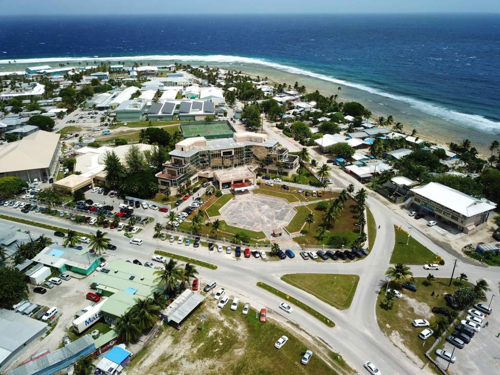
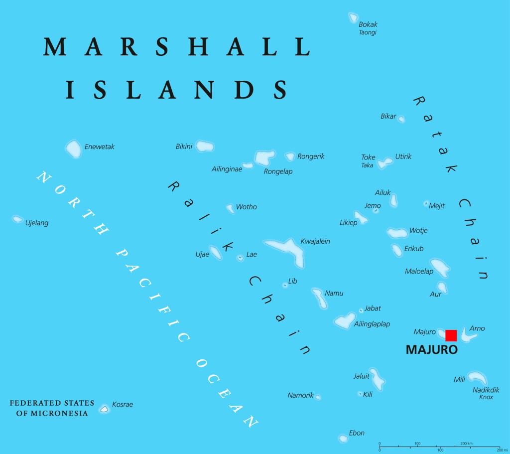
The Republic of the Marshall Islands is an independent country, comprising 5 islands and 29 atolls (coral reef islands). Around 30,000 of the 40,000 inhabitants live on the capital island, Majuro.
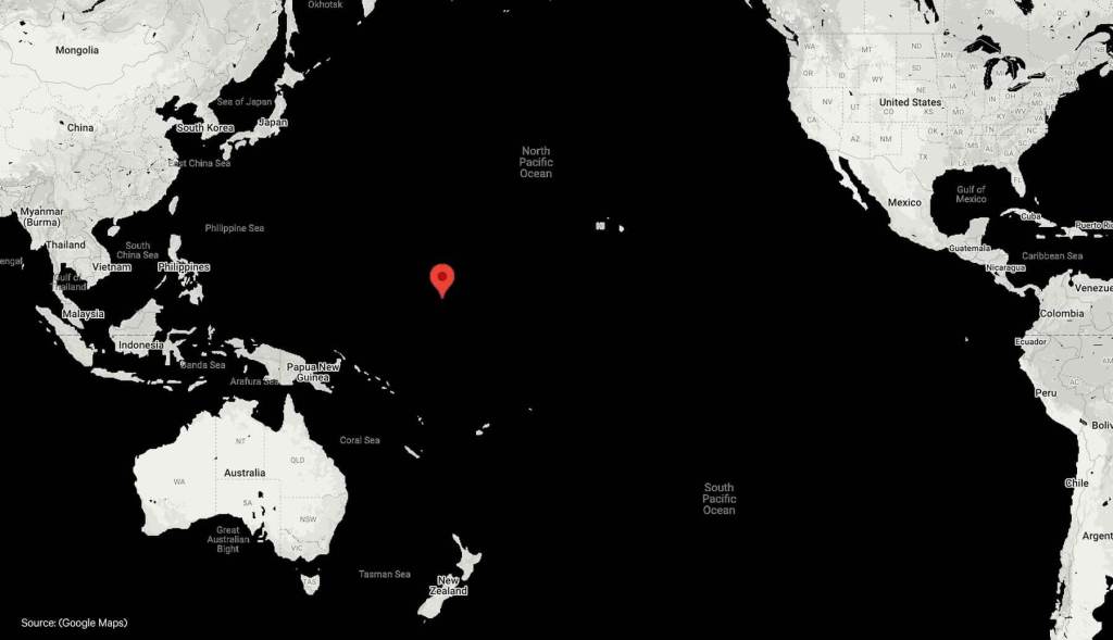
We’re situated in the middle of the Pacific Ocean between Hawaii and Australia. It takes over 3 hours to fly from Guam, 5 hours from Hawaii and 7 hours from Australia.
Our biggest match is against the world
We may look like a tropical paradise, but our nation is facing an existential crisis. As a low-lying island nation we are hugely affected by climate change induced flooding. If global temperatures rise by more than 1.5 degrees then some of the islands may become uninhabitable. When is this projected to happen? 2030. That’s what makes our project all the more pressing. There is no time to lose.
If climate change continues at the projected rate then 40% of the buildings in the capital city, Majuro will be lost. 96% of the city is already at risk of frequent flooding leaving residents continually living in fear of storms.
Our project isn’t just about bringing football to the nation. We want to raise awareness of the catastrophic situation facing us, and campaign for changes that will reverse climate change before it’s too late.
Resources:
Video
- My Fish is Your Fish. Tells the story of nuclear weapons testing on the people and places of the Marshall Islands with interviews of survivors.
- The Last Days of Majuro. Detailing the affects of climate change on Majuro.
- Marshall Islands: Projected Sea Level Rise. A World Bank study visualizing risk of projected sea level rise.
Organizations
- Jo-Jikum. A non-profit empowering Marshallese youth to develop solutions to environmental issues impacting the Marshall Islands such as pollution, climate change, and nuclear legacies. Co-founded by Kathy Jetnil-Kijiner, prominent artist and activist.
- Voices Rising. Amplifying Marshallese voices to enable positive action that will sustain life in the Marshall Islands.
- Marshallese Arts Project. A University of Edinburgh project to promote the well-being and resilience of Marshallese culture and communities.
- What “Nuclear Justice” Means. Written by Benetick Kabua Maddison.
Marshall Islands Factfile
- Official language: Marshallese, English is widely spoken
- The Marshalls are composed of more than 1,200 islands and islets in two parallel chains of coral atolls—the Ratak, or Sunrise, to the east and the Ralik, or Sunset, to the west
- None of the 29 low-lying coral atolls and the five coral islands in the Marshall group rises to more than 20 feet (six metres) above high tide. The islands are coral caps set on the rims of submerged volcanoes rising from the ocean floor.
- The island units of the Marshalls are scattered over about 180,000 square miles of the Pacific. The largest atoll in the group and in the world is Kwajalein, which has a land area of only six square miles but surrounds a 655-square-mile lagoon.
- Kwajalein is home to a US army base
- In 1946, the US relocated residents of Bikini Atoll to use it as a testing ground for atomic bombs until 1958. The largest explosion was from the Castle Bravo test in 1954, which was 1,000 times more powerful than the atomic bombs dropped on Hiroshima. Inhabitants of nearby islands are still suffering from the effects today.
- The Marshall Islands’ nearest neighbours are Wake Island (north), Kiribati and Nauru (south), and Federated States of Micronesia (west)
- The climate is tropical, with a mean annual temperature for the entire group of 82 °F (28 °C)
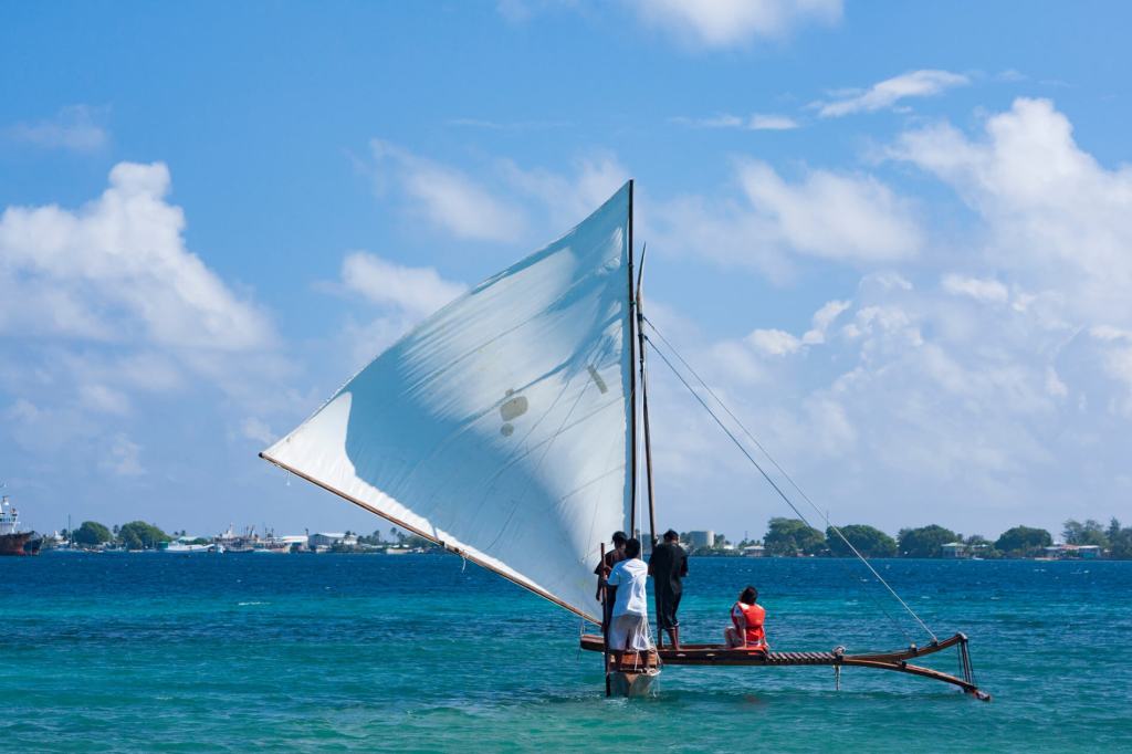
For more than 2,000 years, the outrigger canoe has been the sole means of transportation upon which the life of the Marshall Island people relied.
